Machine learning systems
Model Training
Targeted models associated with specific topics of inquiry.
Model Training
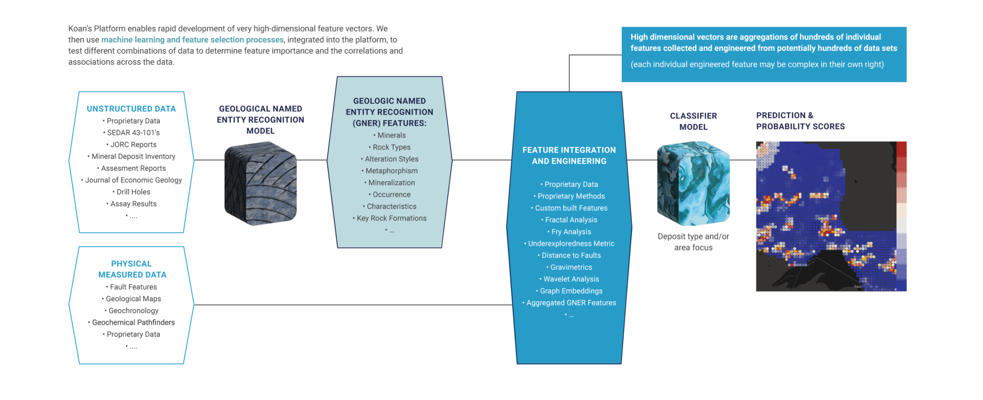
Providing advanced geospatial analyses requires the development of targeted models associated with specific topics of inquiry. Koan typically starts with enormous volumes and heterogeneous types of data: unstructured data, measured data and engineered features that we gather or construct. From these data features (sometimes >1,000), Koan uses different machine learning methods to evaluate the importance of features through various iterative selection and optimization processes. Once the selection of features is made, these models can be used on new geographic areas, or with fine-tuning, be applied to other adjacent problem sets.
Rapid model training is only possible with the underlying technology and software development that allow us to build new engineered features and effectively manage: feature selection, model selection, and testing.
Platform visuals
Model training interface